|
Corn Hill To
Wednesfield Road part 1 |
|
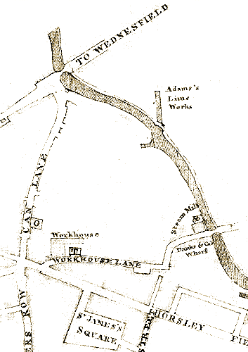
Part of the 1827 map. |
The map that is included in Smart's Trade
Directory of 1827 shows very few buildings
alongside this part of the canal. On Corn Hill there
is the Old Steam Mill, and Danks and Company's
wharf.
Just north of the site of today's High Level
Station is a basin leading to Adams's Lime Works.
The firm is listed in Pigot & Company’s Directory of
Staffordshire for 1842 as James Adams, Lime Burners,
foot of Canal Street. The wharf was known as Lime
Wharf.
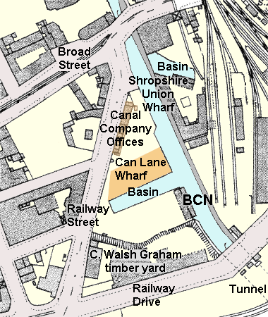
One of the main wharves in the town centre was
Can Lane Wharf and basin, which is shown on the map
as a very short basin, opposite the entrance to
Adams's basin.
There was also an entrance to the canal at
the junction of Can Lane and Broad Street, which was used by some of the packet boat companies
that took passengers to and from Birmingham. This
area, later referred to as Broad Street Wharf was
used by coal merchants Beebee Brothers in the 1930s.
Because the canal followed the 473ft. contour
around hilly Wolverhampton, it avoided the town
centre, and followed a route to the north east.
|
| By the time the 1842 Tithe map had been
surveyed, Can Lane had become Railway Street, and
Can Lane basin had been greatly extended.
The layout of this part of the canal soon changed
with the coming of the railway.
When the Shrewsbury and Birmingham Railway, and
the Stour Valley Line were built in 1849 to 1851,
the canal was diverted to its current path, in a
cutting stretching from Corn Hill, almost to Broad
Street. The two ends of the original section were
left as basins at Corn Hill, and Broad Street.
The approach to the new railway station was over
the canal, and so part of the cutting was
roofed-over to form a tunnel, now known as
Wolverhampton Tunnel. |
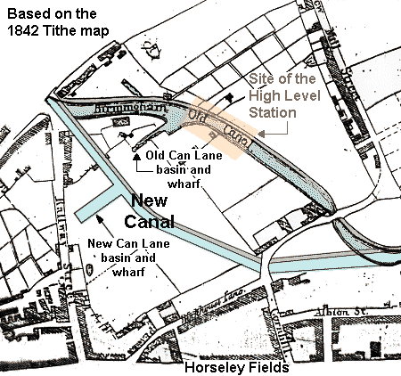
From the 1842 Tithe map, with
the addition of the new canal. |
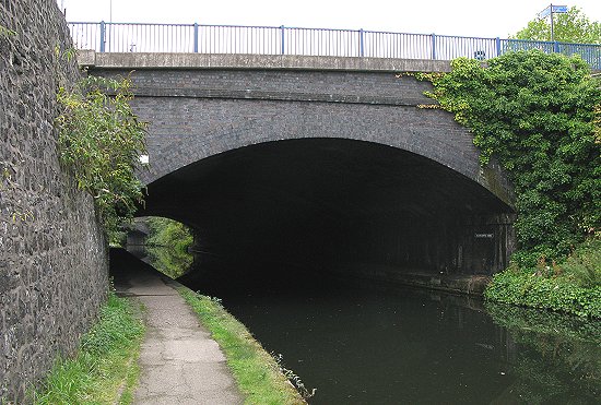
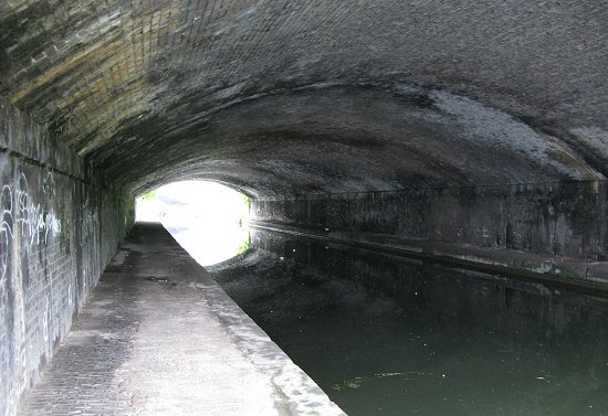
The northern end of Wolverhampton Tunnel.
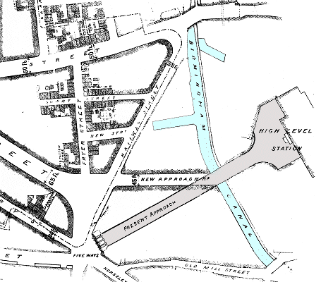 |
In the early 1880s the old Lichfield Street was
widened, and extended from Princes Square to
Victoria Square. This then became the main approach
to the railway station, instead of Queen Street.
As a result Railway Drive was built from Victoria
Square to the High Level Station. Part of the work
consisted of extending the canal tunnel to
accommodate the new road.
This is shown on the illustration opposite, which
is from the Midland Counties Express, April 9th,
1881. |
Another view of the northern end of the tunnel. The
nearest dark line in the roof marks the end of the original tunnel, and the beginning of the extension. |
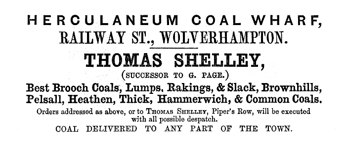
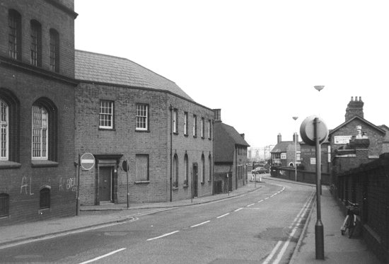
| The canal company's warehouse and offices were
located in Railway Street next to Can Lane Wharf.
The wharf has been used for the unloading of
coal, limestone and bricks etc. Over the years many coal merchants
have been based there.
In 1851 Richard Brawn was based at the wharf,
selling coal and lime. In the late 1870s the wharf was used by Elias
Crapper and Company, lime merchants, and Fred Walker
and Company, coal merchants. Another coal merchant,
J. H. Shepherd & Son used the wharf around 1913.
In the 1930s two coal merchants were located
there, Harley & Son, and B. H. Smith, and in the
1940s the F. and B. Coal Company
(Wolverhampton) Limited, and T. J. Wright.
In the early 1950s the wharf was used by coal
merchants A. J. Baugh, the Astbury Delivery Company
Limited, H. L. Devine Limited, P. W. Bright, and
Thomas Meredith. Another coal merchant, T. Foster
and Son was based in Railway Drive, as were the
Economic Coal Company in 1913.
|
The canal and wharves in 1919. |
An advert from 1861.
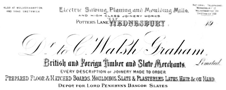
| On the southern side of the wharf, in Railway
Street and Railway Drive was the saw mill and timber
yard of C. Walsh Graham Limited.
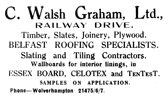
An advert from 1934. |
The canal company's buildings in Railway
Street. Courtesy of David Clare.
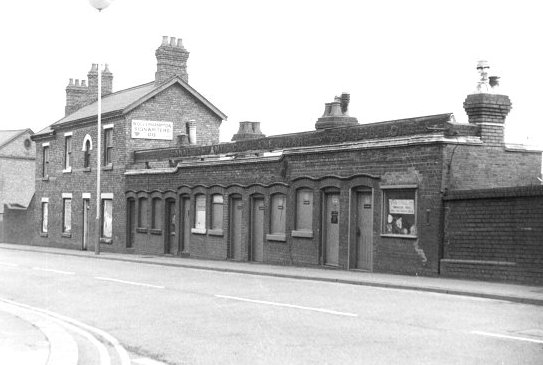
 |
Looking down Railway
Street towards Broad Street in the early 1970s.
Courtesy of David Clare. |
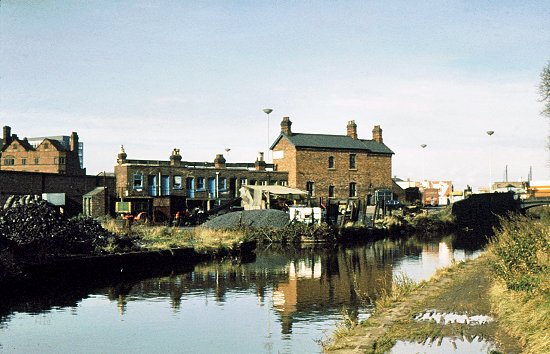
| Can Lane Wharf and the
canal company's buildings seen from the canal in the
early 1970s. At the
time it was used as a coal wharf.
Courtesy of David Clare. |
 |
| The strip of land alongside the canal between
Can Lane Wharf and Broad Street was used for the
Swift Packet Boats that carried passengers between
Wolverhampton and Birmingham in the 1840s and early
1850s. The Swift Packet Company was owned and
operated by James Shipton whose canal carrying
business was based at Albion Wharf. The company
began to operate on 1st August, 1843 using Scottish
built iron boats. The boats were pulled by two
horses, the leading one was blinkered, and the
second one ridden. The horses would be changed
every 4 miles or so and could reach speeds of up to
10 miles an hour.
The packet boats were given priority at locks,
and operated for 6 days a week, Sundays excepted.
Shipton had to pay a high toll for using such fast
boats on the canal, which would have damaged the
infrastructure. In 1843 there were 2 return trips
daily, which covered the 13½
miles to Birmingham in 2 hours and 10 minutes. There
were first and second class cabins, called the chief
cabin, and the second cabin respectively. In 1843 a
first class fair from Wolverhampton to Birmingham
was 1shilling and 6 pence, a second class fair cost
1 shilling. By 1846 there were 7 return trips a day,
but by 1851 the number had been reduced to 4.
In White's 1851 Staffordshire directory the Swift
Packet Companies' entry is as follows:
Swift Packets to Dudley and
Birmingham from the wharf, Railway Street at 9 and
12 in the morning, and 3 and 6 in the afternoon.
Messrs. James Shipton, Edward Gibbs, and Charles L.
Browning - proprietors. William Hilton - clerk.
Intermediate stops on the way to Birmingham were made at Bilston, Deepfields, Coseley, Tipton, Dudley Port, Oldbury,
and Smethwick. The business must have suffered
greatly when the Stour Valley railway line opened in
1852. There were initially 8 trains a day in each
direction, which completed the journey in 50
minutes. It seems likely that the Swift Packet
Company ceased to operate before the year was out,
because three of the boats were sold in February,
1852. |
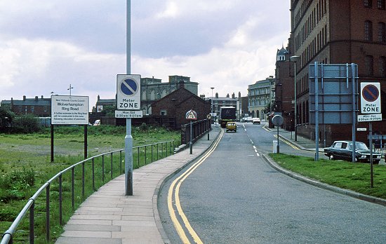
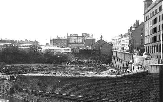
| In the 1980s the canal side changed dramatically
with the building of the final section of
Wolverhampton's ring road; Ring Road St. Davids.
The wharves and Railway Street disappeared as the
new ring road was built alongside the canal.
Photo courtesy of David
Clare. |
 |
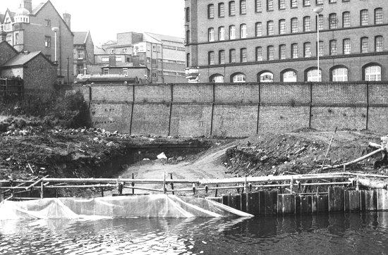 |
A scene of dereliction as Can Lane Wharf
disappears forever.
Photo courtesy of David
Clare. |
| A last view of the once industrious area where
all kinds of goods were loaded and unloaded to and
from the boats. The Swift Packet Company's wharf
would have been on the left, and accessed via a
short walkway on the far side of the brick wall.
Photo courtesy of David
Clare. |
 |
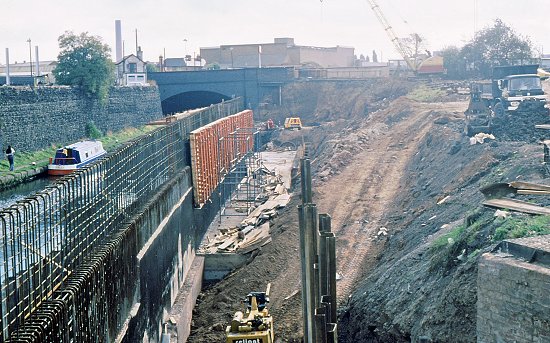 |
The construction work gains momentum as
the retaining wall is built alongside the canal, and
the area is in-filled with thousands of tons of
earth.
Photo courtesy of David
Clare. |
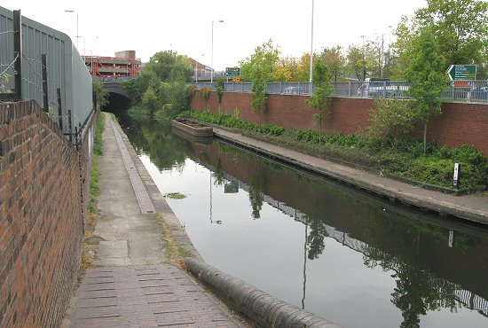
| Ring Road Saint Davids, the only section of the
ring road not named after a local church, was
completed in the late 1980s.
This is how it looks today. |
 |
 |
Return to the
previous page |
|