|
Images
of Wolverhampton from Old Postcards
by Bev Parker
Old postcards often include interesting views of
areas that are long gone or have changed considerably,
and so are a source of useful information. I have
selected a number of interesting views of different
areas of the City, some of which have changed
considerably and others which have hardly changed at
all. |
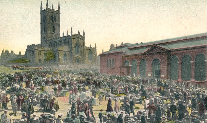
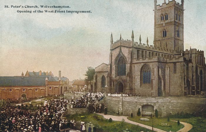
A busy summer's market day in the old market
square. The scene is from around the turn of the
twentieth century because it is after the demolition
of the Exchange Building in 1898 and before the
opening of St. Peter's west front gardens in 1907.
On the right is the retail market that opened in
1853 and remained in use until the modern market
building on the corner of School Street and Salop
Street opened in June 1960. |
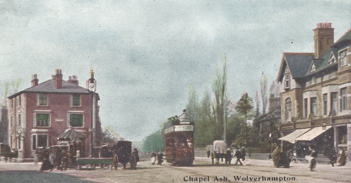
A view of the western end of Chapel Ash in the early
years of the 20th century, some time between 1902 and
1908 when the card was posted. In the centre is a tram
on its way to Tettenhall and on the left in front of the
Georgian house is the old cab drivers shelter and public
toilets. The scene has changed very little and looks
much the same today. |
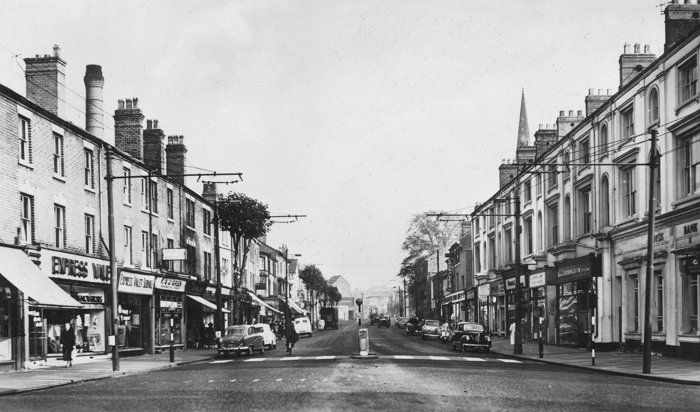
Another view of Chapel Ash looking in the opposite
direction, possibly from the 1960s. On the left behind
the shops is the chimney that's part of Wolverhampton
and Dudley Breweries' Park Brewery and on the right is
the spire of St. Mark's Church. The scene has changed
little apart from the trolley bus wires and the absence
of the ring road and traffic island in the distance. |
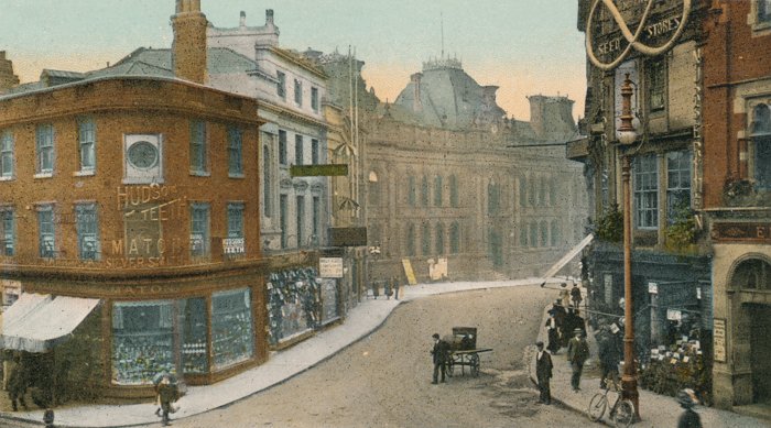
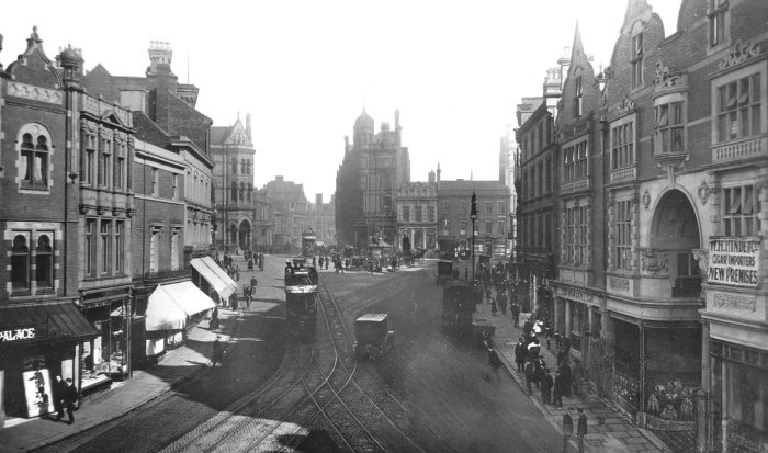
North Street looking towards the old Town Hall that
was built in 1869 to 1871. On the extreme right is part
of the Empire Palace of Varieties and next door on the
corner is Baker's flower shop.
The western side of the street is much the same
today, only the shop fronts have changed. |
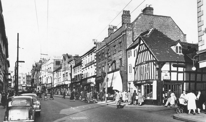
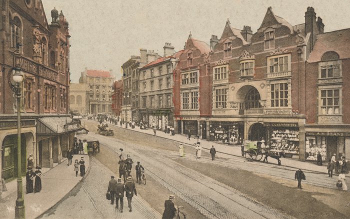
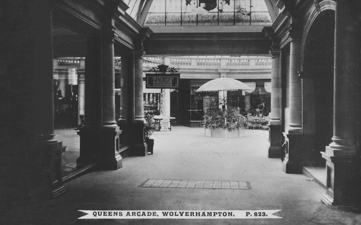
A 1960s view of Victoria Street. On the right is
John Street and on the corner is the half-timbered
building known as Lindy Lou's. In the distance is the
Star and Garter hotel, the outline of the Queen's Arcade
building and the Times Furnishing store in Queen Square. |
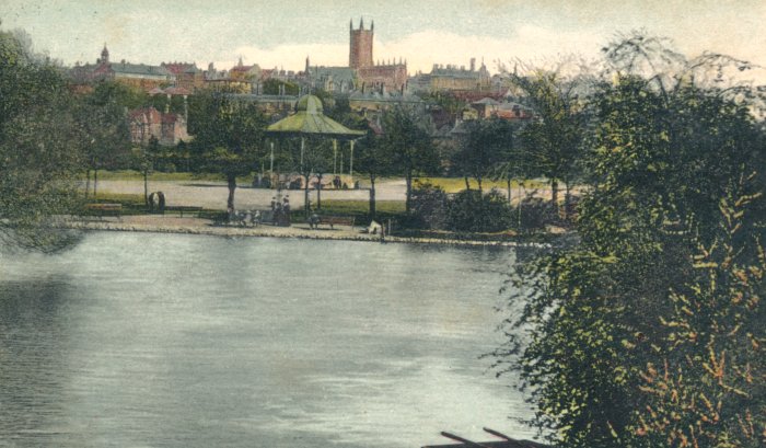
A fine view across the lake in West Park looking
towards the town centre showing the old bandstand. The
view includes the Royal London Building and so dates
from between 1902 and 1906 when the card was posted. To
the right of the church is the old Town Hall and behind
it is the chimney of Manders' paint works in John
Street. In the distance on the left is the Molineux
Hotel clock tower. |
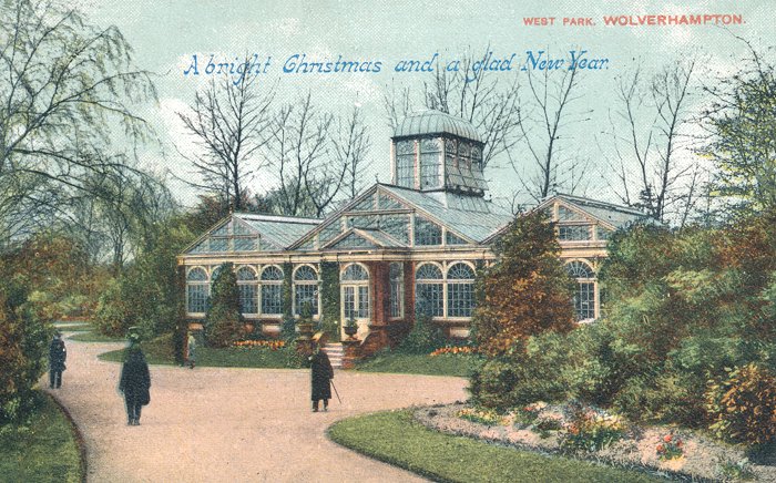
A fine photograph of the West Park conservatory
taken some time before 1907. The conservatory was built
in 1896 at a cost of £1,500 that came from the proceeds
of the town's 1893 Floral Fete and designed by Thomas
Mawson and his architect partner Dan Gibson. It is the
only surviving example of a Victorian park conservatory
in the Black Country. |
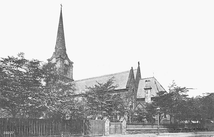
A fine view of St. Mark's Church from St. Mark's
Road. It was a Commissioners' Church, built under the
Church Building Act of 1818 by C.W. Orford and completed
in 1849 at a cost of £4,850. Next door is a fine
vicarage, erected at a cost of £2,000 in 1875. The
church's future was in doubt for some time until its
conversion to offices in 1990. |
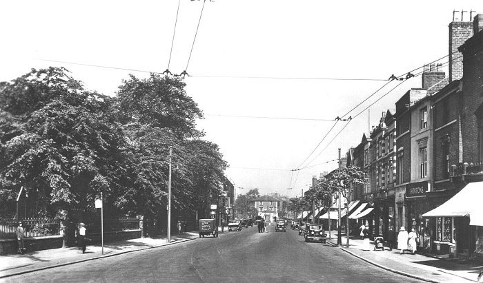
A view of Chapel Ash looking towards Tettenhall
Road. On the right is Hortons (Chapel Ash)
Limited, drapers shop. It was once a very
popular shopping area, particularly before the
redevelopment of St Mark's Road, Great Brickkiln
Street and the surrounding area. |
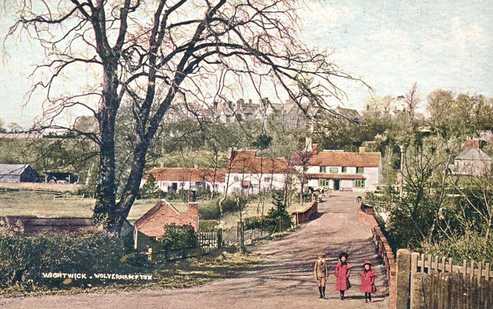
Looking down Windmill Lane towards Wightwick canal
bridge. On the skyline is Wightwick Manor and on the
opposite side of the Bridgnorth Road is the Mermaid
public house. The photograph was taken some time before
1900 when the coach house and cottages alongside the
Mermaid were demolished. |
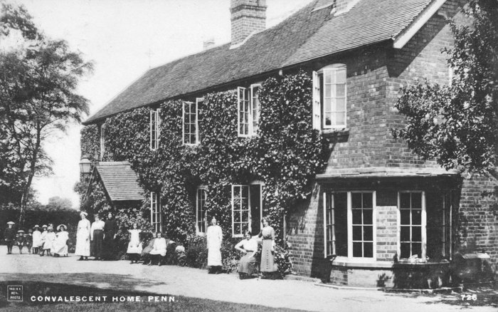
The Penn convalescent home opened in 1873 when
Harriet Sparrow admitted children from the
Wolverhampton and Staffordshire General Hospital. In
1885 she presented the home to the hospital and it
became known as St. Catherine’s Convalescent Home. A
committee of ladies were appointed to supervise the
home which soon outgrew the building and larger
premises were purchased. The new home, called 'The
Beeches' opened in 1935. |
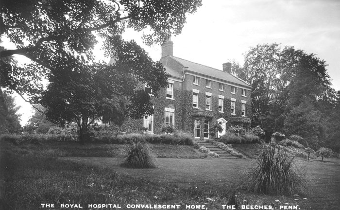
The Beeches at Penn, The Royal Hospital
Convalescent Home. Although initially a
convalescent home it was converted to a 30 bed
children's hospital during the Second World War.
The building included a classroom with 2 school
teachers to ensure that the children's
educational needs were met. After being closed
for many years the building is now a training
centre for psychiatric staff. |
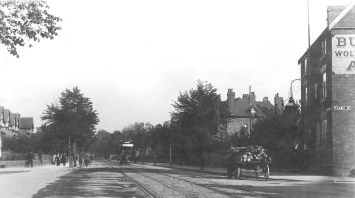
Tettenhall Road with Paget Road and the Halfway
House pub on the right. Only a few changes have taken
place since the photograph was taken. The tram lines
have disappeared and modern traffic lights and street
lighting are now dominant features. Very little traffic
can be seen on the Tettenhall Road, which of course
today is extremely busy. The Halfway House is so called
because it is halfway between London and Holyhead. |
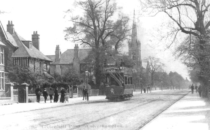
Another view of the Halfway House from across
Tettenhall Road. Apart from the tram the road is
deserted, something that wouldn't be seen in today's
busy world. The tram appears to be electrically powered
and so the photograph was taken sometime after 1902 when
the service commenced and before 1908 when the card was
posted. |
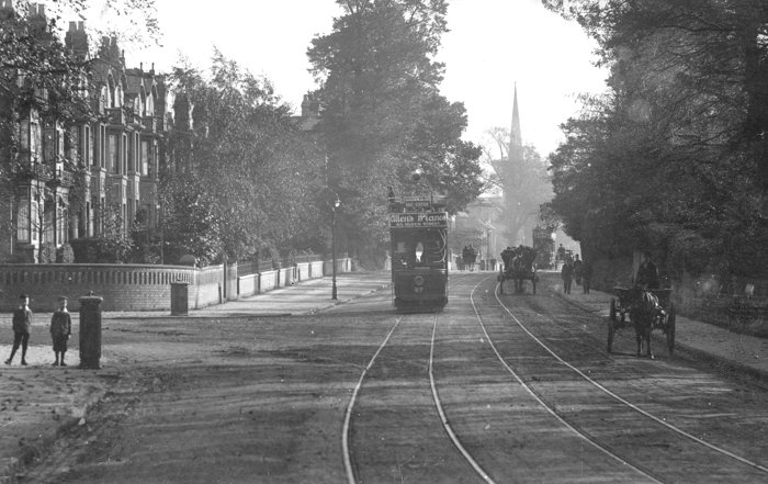
A final view of the Tettenhall Road looking
towards St. Jude's Church. The tram, number 27,
carries an advert for Allen's Pianos in Queen
Street. Other than the two trams the road is
dominated by horse-drawn vehicles. |
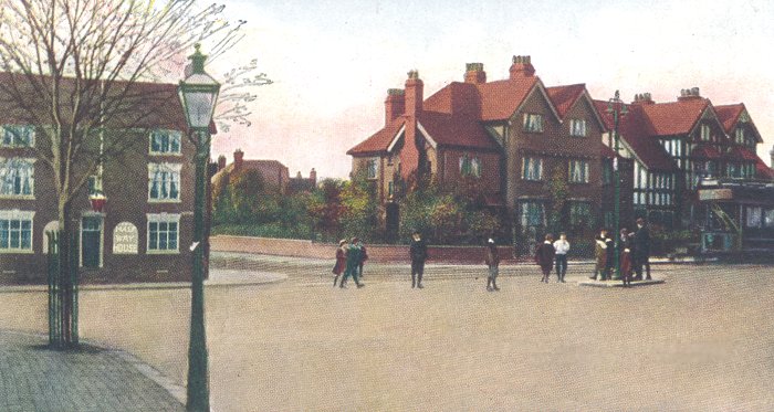
Another view of Tettenhall Road from about the
same time. Behind the tram is the south eastern
entrance to Balfour Crescent. |
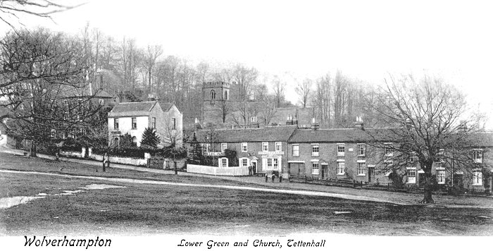
Lower Green, Tettenhall and St. Michael's Church. In
the centre is the Mitre Inn that sold Butlers Ales and
to the left is the White House, thought to date from 1820,
but possibly earlier. St.
Michael's Church was badly damaged by fire in 1950 and
subsequently rebuilt. |
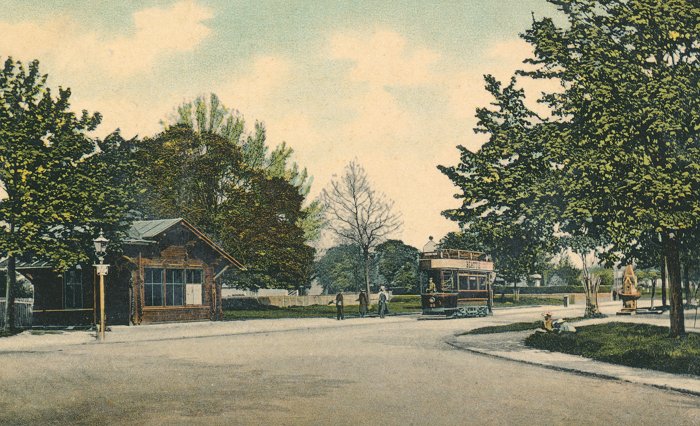
The Junction of Wrottesley Road and Wergs Road at
Tettenhall. The building in the centre is the tram
shelter that came from West Park after the 1902 Art
and Industrial Exhibition. It remained in use until
the 1970s. A Lorain tram can be seen approaching the
terminus with several people waiting to board. On
the right is the Victorian drinking fountain from
1890 that was moved away from the road and restored
several years ago. |
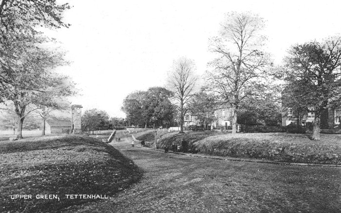
Upper Green, Tettenhall. In the distance is the
memorial tower and clock that was built in 1911 to
commemorate the coronation of King George V. Mr. and
Mrs. Edward Swindley of the Cedars, Tettenhall presented
the clock to the Urban District of Tettenhall on 22nd
June 1911. |
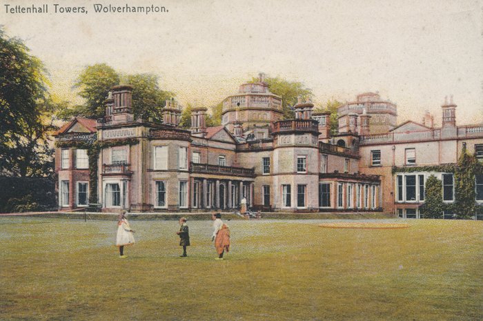
Tettenhall Towers was built in 1763 for Thomas
Pearson and the two polygonal towers, after which the
building is named were added in 1866. It is remembered
as the home of Colonel Thorneycroft who became the
tenant in 1851 and purchased the property in 1854. By
1880 he had added a private theatre seating 500 people,
featuring special effects including a giant 44ft.
cascade of water. The buildings became part of
Tettenhall College. |
|
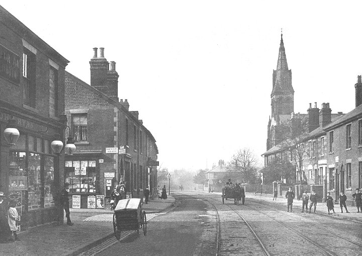
New Hampton Road West. |
|
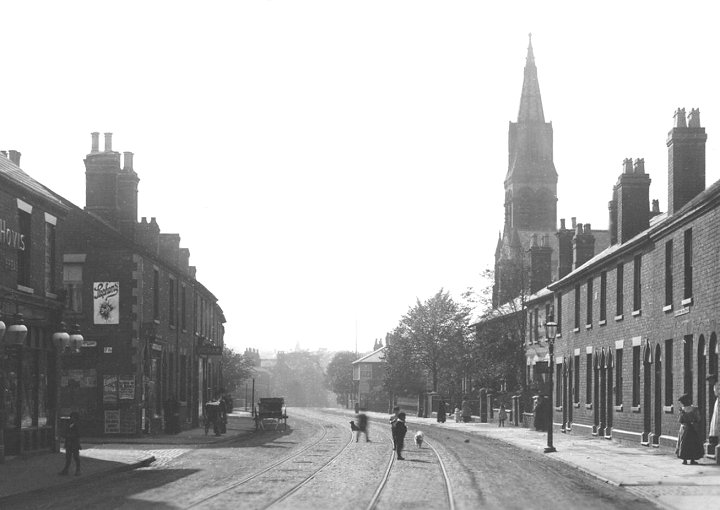
Another view of New
Hampton Road West. |
 |
Return to
the
previous page |
|