Broad Street.

The middle of Broad Street looking towards the Union Inn and the railway bridge.

All of the buildings in the photograph except for the old canal warehouse at the bottom have gone.

On the right is Fryer Street and behind the nearby street lamp is Broad Street Garage. Broad Street was originally called Rotten's Row and with the coming of the canal was renamed Canal Street.

This photograph was taken behind the shops that are on the left-hand side of the photograph above, during demolition.

The shops backed onto the notorious Carribee Island, an area of squalor that was redeveloped after the Artizans Dwelling Act of 1875 had been Passed.


Demolition in Broad Street.


More demolition.

The end of Broad Street Garage and the buildings at the bottom of Fryer Street.

A few years later the Chubb building in the background, built in 1889 was renovated and now houses the Lighthouse Media Centre and Cinema, and small industrial units and offices.

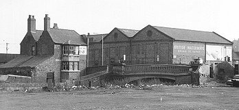
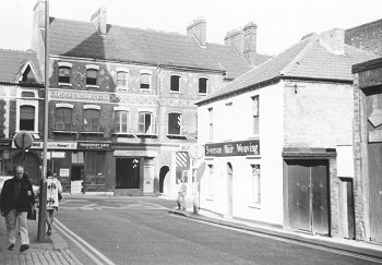
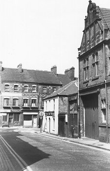
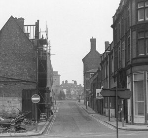
On the left is the surviving canal warehouse and the old canal bridge.

The bridge was removed when the road was widened and was taken to the Black Country Living Museum where it can be found in the Black Country village.

On the right of the canal bridge is Railway Street and the Squirrel pub, both of which disappeared when the ring road was built through here.


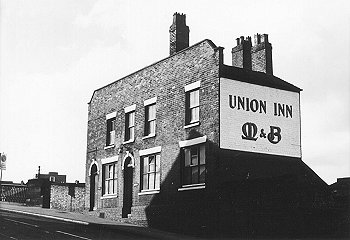
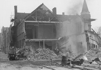
The Squirrel pub, Broad Street.


Derelict land by Broad Street Basin.

The old canal landscape has changed beyond recognition.

On the left is the Union Inn which was demolished in the mid 1970s and in the centre is the old canal bridge which was removed a short time later.

The canal warehouse has more recently found new life as a night club.

The Union Inn was used for bed and breakfast by the canal boatmen when Broad Street Basin was a busy place.

The outbuildings included stables where the boatmen's horses could be kept overnight.


The Union Inn, Broad Street.


Broad Street viewed from the bottom of Fryer Street.

All of these buildings were demolished shortly after the photograph was taken.

The buildings on the opposite side of Broad Street housed what appears to be a bed and breakfast boarding house called 'Transport Accomodation' and a transport cafe.

Next door was Beckminster Press and Ray's hairdressing. On the opposite side of Fryer Street was Svenson Hair Weaving.

The building on the right was occupied by Pickford's removals and much earlier by motorcycle manufacturer HRD.

A look at Isaac Taylor's map of 1750 reveals that Fryer Street was built on the site of Fryer's brick works and yard, after which the street was presumably named.


Another view of Fryer Street.

Another view of Pickford's building.

In the distance are the buildings at the corner of Piper's Row and Horseley Fields which were demolished shortly after the photograph was taken.


Looking up Fryer Street from Broad Street.


Looking up Long Street towards Fryer Street.

This part of Long Street has now disappeared, it used to run into Railway Street.

The building being demolished is the back part of Pickford's warehouse.


Return to the photograph album