|
|
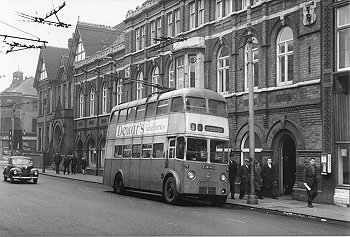
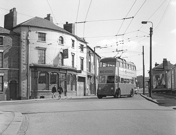
This view shows the front of the
Drill Hall which was built in the early years of the last
century. The hall itself was behind these buildings and was
demolished in the late 1960's. Before the Civic Hall opened in
1938 this was the venue for many concerts and even early film
shows. It was disliked by both audiences and performers and was
described as draughty with terrible acoustics.
Mr. A. J. Sheldon
of the Birmingham Post described it as follows;
"Wolverhampton may possess a capable fire brigade, yet if ever
the Drill Hall of the town should become ablaze the imagination
can visualise the musical enthusiasts of the city making a
united stand against the passage of anybody attempting to save
the building".
The late
1940's Sunbeam trolley bus is on the number 3 Fordhouses
route. |
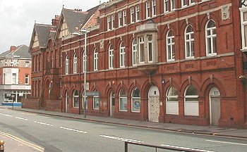
| On the corner of Whitmore Street is
the local branch of the Co-Operative Insurance Society, and to
its left is Gilson's shop. The bus stop on the left is for the
number 9B that ran to Peartree Lane.
The buildings on the right have changed very little, but those
on the left were demolished in the mid 1950's as part of the
Staffordshire College of Technology's expansion along Stafford
Street. It is now part of the University. |
|
|
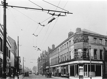
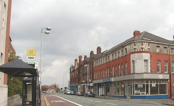
This view looking towards town was
photographed in the mid 1950's. On the extreme right-hand side
is a chemist's shop and behind it can be seen the steel
framework of the University's 'B' Block, then under
construction.
To its left are other University buildings which
were then still new.
The Royal London Building can be seen in
the distance, and on the opposite side of Stafford Street is the
premises of Copes Motor Cycles.
Today's view is quite different. Everything in the foreground
including the two lovely houses, was demolished to make way for
the ring road, which now dominates the scene. |
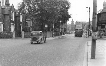
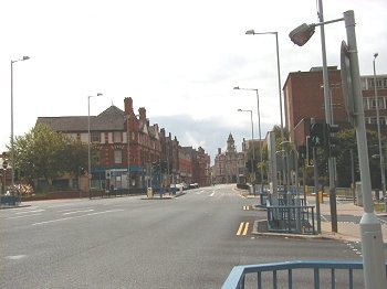
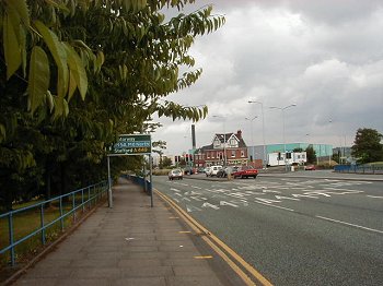
| Stafford Street looking north. On the
extreme right is the premises of G. W. Braithwaite & Son Ltd,
and to its left is Walsh Graham's timber, joinery and roofing
business. The turning on the right by the trolley bus is Wilson
Street and in the distance is the Elephant and Castle pub. On
the left is the turning into Camp Street and immediately after
it is a builders, possibly Jenks.
The street was widened when the ring road was built, and all
of the buildings in the previous picture, except the Elephant and
Castle were demolished. The photograph opposite was taken in
2000, before the Elephant and Castle also disappeared. Unless
you are familiar with old Stafford Street, it is impossible to
guess where the first photograph was taken.
|
|
|
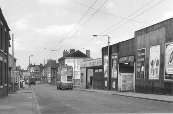
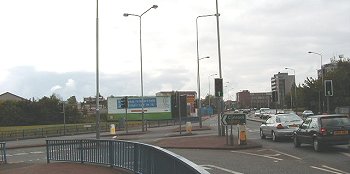
This view from the Cannock Road junction shows a number 9
trolley bus on its way to Fallings Park. The Ansell's pub on the
corner is the Junction.
Today the junction has been widened, and everything in the
previous photograph except for the University buildings in the
far distance, has gone. |
 |
|
 |
Return to the
beginning |
|
Proceed to
Queen Square |
|