BUSHBURY TO THE END OF THE SIXTEENTH CENTURYThe name of the parish The name of the parish, "Biscopsberie", in Domesday, means "land of the Bishop", presumably referring to a Saxon Bishop, although we do not know his name.
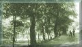
The geography of the parish The ecclesiastical parish of Bushbury with Essington, approximately five miles long from west to east, and at its widest, western end, three miles from north to south, lies to the northeast of Wolverhampton. Essington Manor at the east end was in Cuttlestone Hundred and all the remainder in Seisdon Hundred. In the main the land slopes gently from east to west and is drained by several brooks . Those at the northern end of the parish join the River Penk and so find their way to the North Sea, while those at the southern end travel ultimately to the River Severn and so to the Bristol Channel. In the sixteenth century the old route past the church was still the main road from Stafford to Wolverhampton and Warwick. It entered the parish from Coven, along what is now Dark Lane, into Cat and Kittens Lane, Paradise Lane and Northicote Lane. Bushbury Lane continued through the hamlet of Wollery Green across the "Goosebrook" (Smestow Brook), out of the parish to enter Wolverhampton by North Road and North Street. There was some wheeled traffic, (the Rector owned a pair of "carte wheles"), but for the most part the carriage of goods would have been by pack horse, the rich had their riding horses and the poor walked.
Population and settlement In 1550 the population of the parish was probably no more than two or three hundred people living in scattered small communities, linked by tracks across open country and between small cultivated areas. Some of the land had been cleared by small groups of people felling trees from the edge of Cannock Chase, a process which had been taking place probably since Saxon times, giving rise to such local place names as "Wood End" and possibly "Old Fallings", although in some records this appears as "Old Furlongs" i.e. the long sections in the old "open-field" system of agriculture. It seems unlikely that there was ever a large settlement of houses grouped around the church, as there was in other parishes to the west and south. James P Jones, writing in "Heart of the Midlands" in 1906, says of Bushbury, approaching from Stafford Road along Bushbury Lane, "At the entrance to the village will be noticed some good half timbered houses near by the village school"; but according to maps of the time there were no more than half a dozen cottages scattered along the lane. The reason for this fragmented development possibly lies in the fact that the parish had been divided since mediaeval times into several manors. These were Bushbury, Moseley, Elston, Showell (Seawall or Sewell), Oxley, Wobaston (Wybaston), and Essington. The sites of the manor houses are all known:
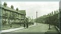
Each manor was the centre of a small community. There were other settlements at Northicote, Underhill, Westcroft, Fordhouses, Coven Heath, Gorsebrook, (earlier Goosebrook) and Brinsford where the settlement was on the opposite side of the road to the present Victorian farmhouse. The old approach to Brinsford, now blocked by the railway embankment, can still be seen (Map Reference 923049). On the western side of the embankment this old route could still be seen crossing a stream on a blue brick footbridge along an overgrown footpath towards the farm, but the whole area was bulldozed flat a few years ago. Two other sites have now disappeared, Rowden Lanes, where the old route to Essington crosses the present Cannock Road, and Wollery Green in the vicinity of the present "Oxley Arms" in Bushbury Lane. Rowden Lanes appears in the parish register well into the eighteenth century, and there is a grave in the churchyard of a resident of that place dated 1845. It seems likely that the path leading into the fields, (now blocked) from the "dog leg" in the lane east of Moseley Hall (Map Reference 934038) was another approach into Rowden Lanes. Another two once inhabited sites, for which we do not even know the names, were destroyed in the building which took place after the Second World War. One was to the south of Legs Lane, from where a footpath led in a northerly direction across the old road to Moseley. The other was in the field at the south east corner of the junction of old School Lane and Bushbury Lane, a crescent shaped pool having the appearance of possibly being the remains of a moat. This could have been the moated site to the west of the church referred to by Stebbing Shaw. These sites could of course have been deserted before the end of the sixteenth century.
Landowning and Agriculture in the parish The principal land owning families were, at Bushbury the Grosvenors; at Moseley the Moseleys; the Levesons owned Oxley and Showell, although they were not resident in the parish. Elston Manor belonged to Lincoln College at Oxford. In addition there was Henry Pitt at Bushbury Hill, a wool merchant like the Levesons, and at Old Fallings were the Normansells and previously the Challenors We know that some at least of the manors had their "open field" system of agriculture. The Reverend Stebbing Shaw, writing at the end of the eighteenth century in his "History and Antiquities of Staffordshire", refers to "Bushbury Great Field" but it has not been possible to identify its boundaries. From Wobaston Manor the records of the Court Leet have survived with many references to its three open fields, Brookfield, Middlefield, and Oxeley Field, although again we cannot at present identify their locations . Sheep farming was probably the principal activity in the parish, like the rest of this part of Staffordshire. Beside the wealthy landowning families there were others like the Underhills at Northicote and the Huntbach family at Showell renting land from the lords of the manors. Even the rector, Richard Willson, had his sheep, fifty seven at Bushbury and another twenty one at Essington. So down the social scale to the poorest, owning no land and dependent for his livelihood on working for the lord of his manor.
Present days survivals There are few visible remains of this time. Some of the larger houses survive. Moseley Old Hall, Westcroft Farm and Pool Farm at Essington still have their timber frames, but in most cases the original infilling has been replaced by brick. There is no example of a small dwelling house, although until 1976, when it was incorporated into a modern home, the sole remaining house in the hamlet of Rowden Lanes, dating from about 1600 could be seen on the east side of Cannock Road. It consisted of an original structure about eight yards by six, the ground floor divided into two parts with a large open fireplace at the east end. Above was another room reached by a narrow spiral staircase. On the north wall was a single storey "lean-to" outshut, probably of later date, used as a scullery.
Bushbury life in the 16th century The inventory of the Rector, Sir Richard Wellson, who died in 1567 (see Appendix I), throws some light on other aspects of life at that time. Coal was available for those who could afford it. Meat (beef and bacon) was salted to provide food over the winter months, when fodder for animals was in short supply, and of course the sheep provided food as well as wool, which could be spun and woven in the home, together with hemp and flax to provide clothing and other household textiles. Little other documentary evidence from this period is available, although we do get a glimpse of one of the important rituals of the parish, "Beating of the Bounds" of Bushbury Manor, which took place on September 12th 1588. A group of men and boys of all ages walked the perimeters of the manor and so ensured that knowledge of these boundaries should be handed down from one generation to another, before maps came to be made. Accounts of this ceremony survive.
|