 |
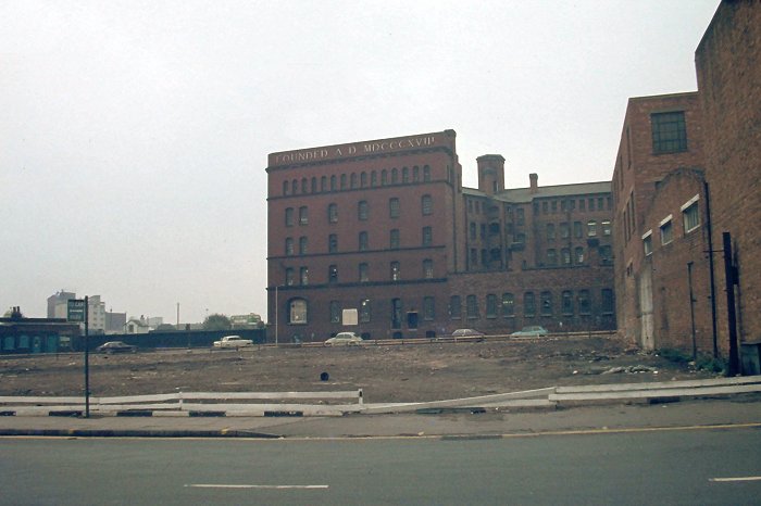
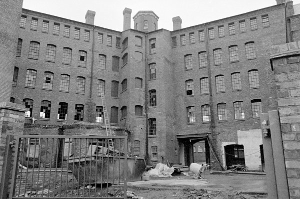
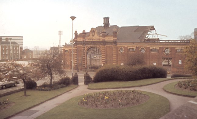
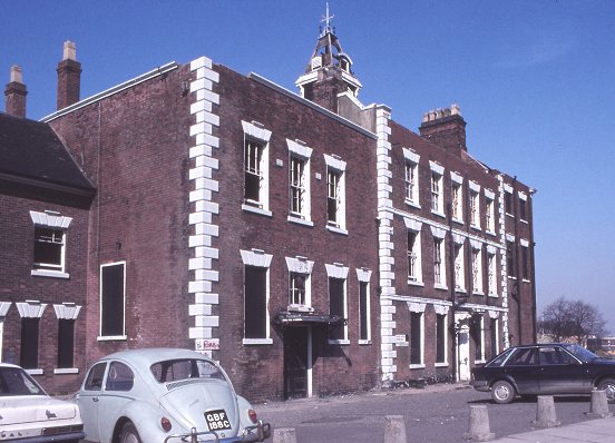
The Chubb Building during renovation in the early 1980s,
before the building of the St David's section of the Ring
Road.
Chubb, founded by Charles and Jeremiah Chubb came to
Wolverhampton
in 1820, just two years after inventing a patent detector
lock. |
| In 1836 the company moved into premises in Temple
Street, then moved to St. James' Square, and two years later
moved again into what had previously been the workhouse, on
the corner of Horseley Fields and Mill Street. Many
patents were taken out for locks and safes, and in 1837
Chubb opened a factory in London. |
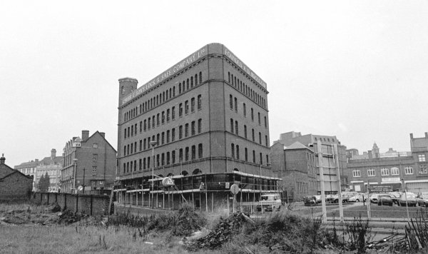
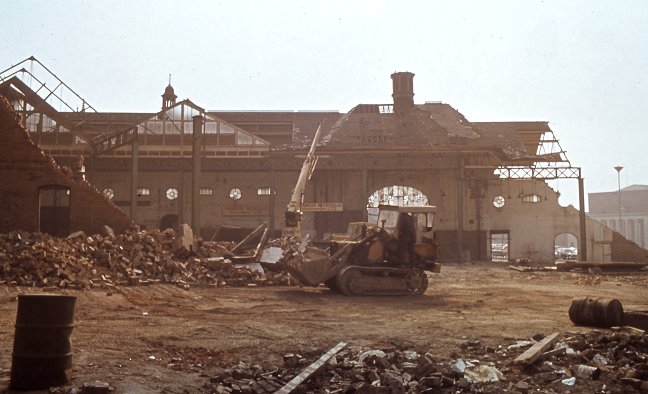
Another view of the Chubb Building. |
|
Chubb became a limited company in
1882, the year in which the Wolverhampton lock factory
closed, due to the termination of the lease. Work soon
began on a new factory in Railway Street, Wolverhampton,
which is now known as the Chubb building. It opened in
1889 and could accommodate 350 locksmiths, and 350 safe
makers. In 1908 the London factory closed in order to
concentrate production in Wolverhampton.
A second Wolverhampton factory for
the production of safes was built on a ten acre site in
Wednesfield Road. In 1938 a new lock factory and offices
opened in Wednesfield Road, extending the area covered
by just over 6.5 acres.
Chubb soon vacated the Chubb
Building, which was taken over by Baelz Equipment
Limited, manufacturers of a wide range of handling
equipment for oil and petroleum products. In December
1978 Baelz moved to a new factory in Racecourse Road,
leaving the building empty.
In the mid 1980s, after renovation,
a new chapter began. The building reopened as a business
park with small industrial units and offices, and in
1991 the Lighthouse Cinema opened as part the Light
House development which includes the Lighthouse Media
Centre. |
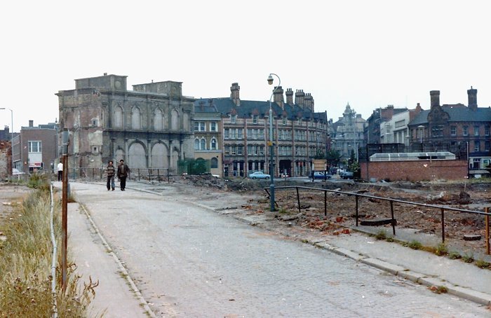
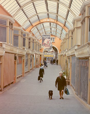
Another of David Parson's excellent photos shows Old
Mill Street, looking towards the Queens Building and
Lichfield Street. The site is now occupied by the
bus station, the modern Victoria Square, leading to
Railway Drive, with the i10 Building to the right,
that contains The Sunbeam pub on the ground floor. |
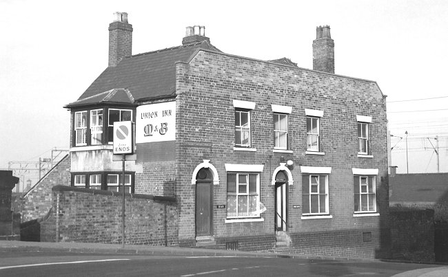
The Union Inn, alongside the canal in Broad Street. It
was originally owned, and presumably built by the BCN,
in around 1800. Wolverhampton's first town centre
railway station, a temporary station built by the
Shrewsbury & Birmingham Railway in 1849, stood next to the pub. |
 |
The Union Inn, just before demolition in the early 1970s
to make way for the St. Patrick's section of the Ring Road,
and the redevelopment of the area. The canal bridge can
now be seen in the village at the Black Country Living
Museum. |
| Springfield Brewery in Grimstone Street, which opened in
1873. It was originally known as William Butler’s
Springfield Brewery.
In 1960 the brewery was taken over by Mitchells and
Butlers of Cape Hill Birmingham. |
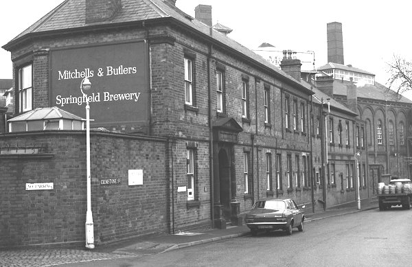 |
| Brewing continued until 1991 when the brewery closed.
During the early years of this century several schemes were
proposed for the redevelopment of the site, but sadly
nothing happened until Sunday 15th August, 2004 when the
brewery was the victim of an arson attack, which resulted in
severe damage to many of the buildings. Unfortunately other arson attacks
followed, and the future of the buildings
looked uncertain. The site was finally made secure, and now
restoration and redevelopment work is underway. |
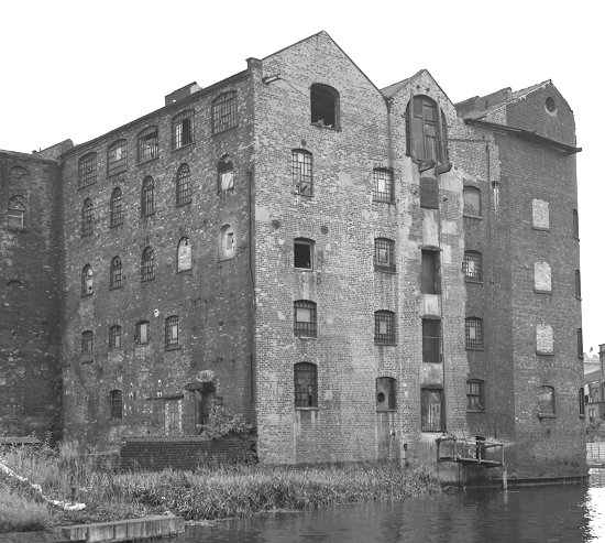 |
Union Mill which stood at the end of Union Mill Street,
by the canal. The mill was set up as a type of
co-operative retailing scheme, to provide flour, and later
bread, for the poorer members of society, who couldn't
afford the high price of flour in the early years of the
19th century.
Members of the co-operative could purchase one pound
shares with instalments of 2 shillings and sixpence a month.
The steam-powered mill had 5 pairs of stones, four of
which would be used for milling the flour, while the fifth
was being dressed. |
| Flour production began early in 1813, and loaves of
bread were on sale before the year was out. Until at least
the First World War, the mill continued to be operated by
the Union Mill
Company. The main building was demolished after a fire in
1989, but two of the rear mill buildings still survive, and
can be seen at the end of Union Mill Street. |
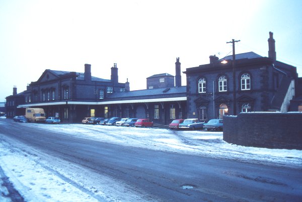
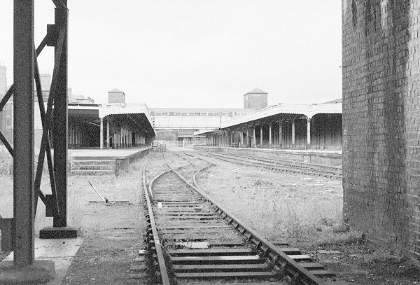
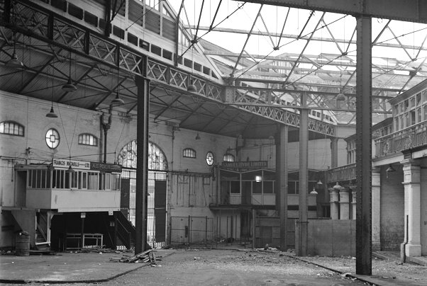
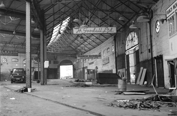
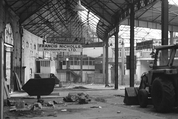
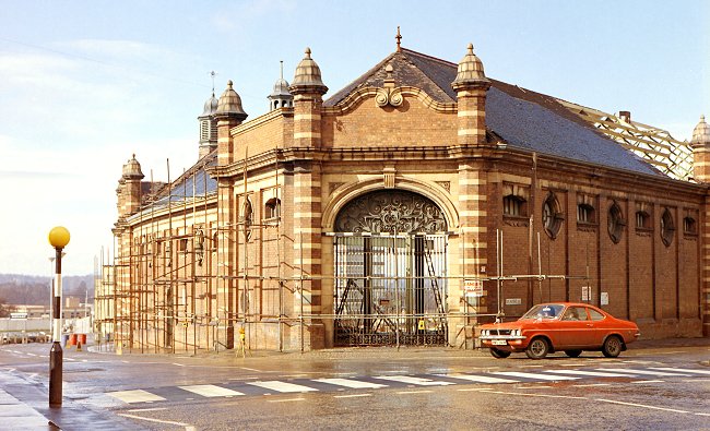
| Wolverhampton Low Level Station which opened in 1854.
The buildings were designed by John Fowler and included a
grand entrance hall with booking offices, waiting rooms, and
refreshment rooms.
It originally had an overall roof designed by I. K.
Brunel. |
 |
|
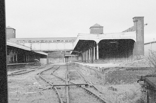
The platforms at Low Level Station. |
The very wide and long platforms prevented overcrowding,
and allowed both up and down trains to arrive on the same
platform at the same time. The platforms were linked by an
iron bridge. |
| The Great Western Railway favoured broad gauge track,
which came as far north as Wolverhampton. The line to
Shrewsbury used standard gauge track, and so mixed gauge
track was laid in the station. In April 1869 the broad gauge
track was replaced by standard gauge. |
| In 1970 the station was converted to a Parcels
Concentration Department at a cost of £30,000. After
removing much of the track, and greatly modifying the
platforms, up to 8,000 parcels were handled each day.
British Railway's policy on parcel handling changed, and
the station closed on 1st June 1981. |
Another view of the platforms at Low Level Station. |
|
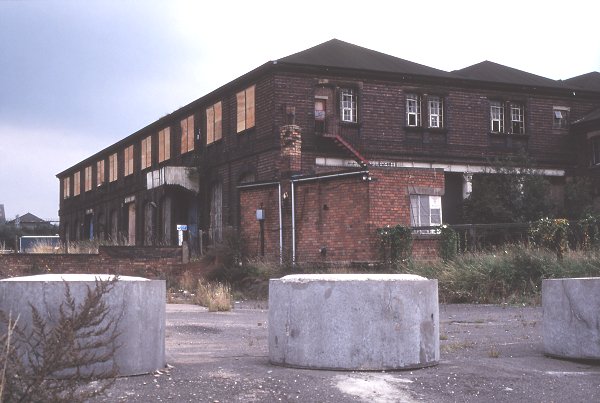
The Midland Railway Goods Depot in Wednesfield Road. |
The goods depot opened in 1881 and continued in active
use until 1966 when local goods operations were centred on
the remodelled Bescot Yard.
The building was leased to Railstores Limited until October,
1988 when it became part of Wolverhampton steel terminal. It
closed in the mid 1990s and was replaced by the Royal Mail
sorting office. |
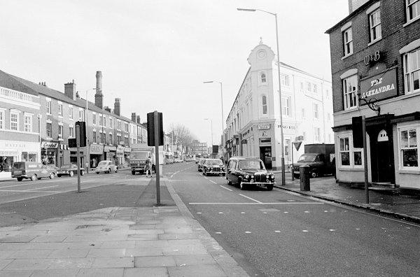
| A view of the northern side of Bilston
Street, near the Bilston Road junction. The shop with the
sunblinds is Woottons Stores, a grocery shop. By the wide
entry next door is E. W. Engineering, a small non-ferrous
foundry. On the right is BA Textiles, and on the corner of
Sharrocks Street is R. C. Butchers. |
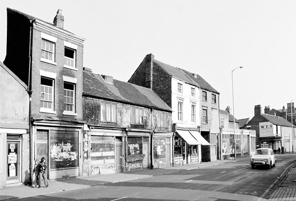 |
| On the far corner of Sharrocks Street is W. E. S.
Wolverhampton Limited, an Electrical Wholesaler. The
company was previously in Bell Street and stocked all
kinds of electrical fittings and goods. |
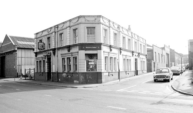
On the corner of Bilston Street and Transport Road is
the Bull's Head public house, which dates from the
middle of the 19th century. Both the pub and Transport Road
disappeared as part of the ring road development and the
building of Bilston Street island. |
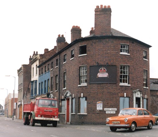
| Another pub in Bilston Street, on the corner of Market
Avenue was the Crown and Cushion. It dates from the 1840s
and originally had a beerhouse license. It also
disappeared with the building of the Ring Road and Bilston
Street island. |
 |
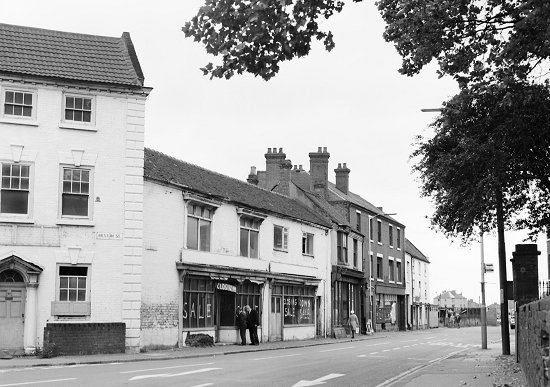 |
Old shops at the junction of Bilston Street, Piper's
Row, and Walsall Street. The empty Georgian house on the
left was previously occupied by M. A. Appleton (Contractors)
Limited. The shop on the left was occupied by L. Morrison, a
radio dealer who sold all kinds of electrical bits and
pieces, much of which was old and outdated. Next door, on
the right is A. G. Tarver Limited, a shopkeeper's outfitters,
and on its right is Collings Supplies Limited. |
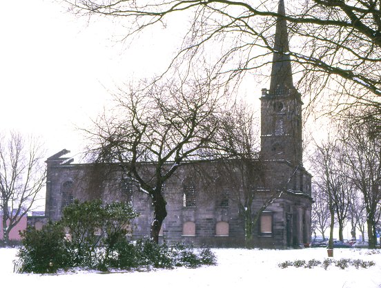
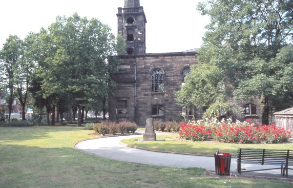
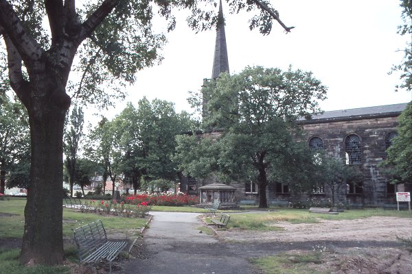
| St George's Church, which is now part of Sainsbury's supermarket.
The church was built between 1828 and 1830, and is
believed to have been designed by the Welsh architect James
Morgan, later a partner of the famous John Nash.
It is built of brick, encased in Tixall stone, and
had a nave with north and south aisles and a short chancel.
It was built at a cost of approximately £10,000, and
consecrated on 26th August 1830. |
 |
 |
In 1849 the graveyard had to accommodate the many
victims of the 1849 cholera epidemic. The victim's bodies
were piled into mass graves which soon covered much of the
area. Because no records were kept of the early
burials the sexton had to use a borer to find empty spaces. |
| The graveyard closed for burials in 1851, and was
landscaped as public gardens in 1898. The church closed in
1978 and fell into a bad state of repair.
After purchase by Sainsburys, it became part of the
supermarket, which opened in January 1988. |
 |
 |
The Clifton Cinema in Bilston Street, during demolition
in 1981. It was built in 1863 as a theatre, and during its
lifetime has seen many changes. It began life as the Prince
of Wales and later became the Star, and then the Hippodrome.
It became known locally as the 'Blood Tub' because many
of the plays at the time featured a murder. When the
original Theatre Royal in Cleveland Road closed, the
Hippodrome became the New Theatre Royal. In 1913 the theatre
was badly damaged by fire and then subsequently rebuilt. It
became the Clifton in 1931 after being converted to a
cinema.
It closed in February 1966 and the following month
re-opened as a bingo club, which finally closed in 1978.
After several years of dereliction, it was demolished to
make way for the new police headquarters which opened in
1992. |
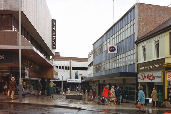
| The old entrance to the Wulfrun Centre at the end of
Dudley Street. The Wulfrun shopping centre opened in 1968
and has since changed beyond recognition.
The overall roof added in the 1990s greatly changed the
nature of the centre and allowed traders to use the
previously open areas. |
 |
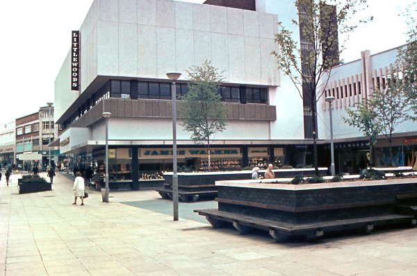 |
This view of the Wulfrun Centre from the mid 1970s shows
just how much it has changed. The open areas are now much
better utilised, and a much friendlier atmosphere prevails. |
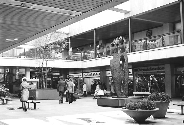
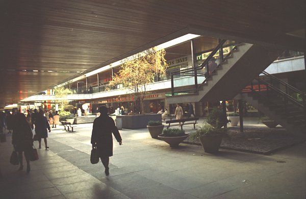
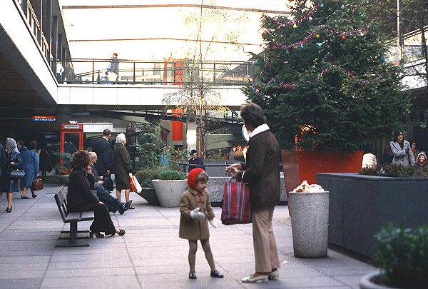
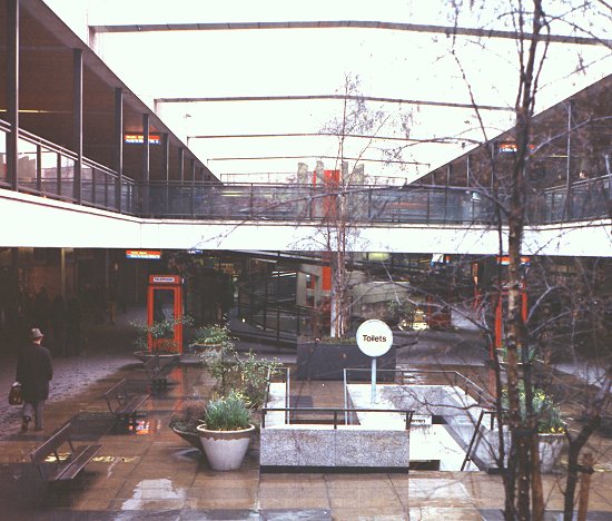
| An early 1970s view of the interior of the Mander
Centre, which opened on 6th March, 1968. It was designed
by James A. Roberts who also designed the Rotunda in
Birmingham.
On the right is Barbara Hepworth's sculpture called 'Rock
Form (Porthcurno)'. |
 |
 |
The centre was built by the property division of Mander
Holdings Limited after the closure of Mander Brothers'
factory in St. John's Street. Part of the interior had to
be rebuilt after a disastrous fire on Christmas Eve, 1970. |
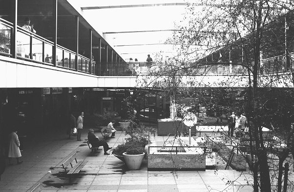
| The Mander Centre has been extensively refurbished, both in
1987 and 2004 in an attempt to retain a modern look that
will appeal to shoppers. In 1987 it became the first
shopping centre in the UK to be fitted with a barrel-vaulted polycarbonate sliding roof,
to provide more comfortable shopping in poor weather. |
 |
 |
The centre, which covers four and a half acres,
originally had space for 134 outlets. The total retail
area now covers around 484,500 square feet, and there
is around 57,110 square feet of office space.
The car park can cater for 550 vehicles. |
| The centre received a Civic Trust award in 1969. In
the 1990s the Mander Centre was sold to the Prudential
Insurance Company.
Although it has been extremely successful over the last
forty years, it is now suffering a little as shoppers are
tending to move away from the high street. Some of its most
prestigious stores such as Woolworths, T. J. Hughes, and
more recently Jessops have now closed. Hopefully the centre
will continue to re-invent itself and continue to have an
important high-street presence in years to come. |
 |
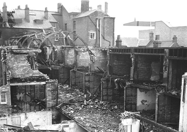 |
The Central Arcade after the fire. Wolverhampton's
last surviving Victorian arcade met an untimely end in May
1974 after a disastrous fire turned it into a pile of
rubble.
Much has been written and speculated about the cause of
the fire, which conveniently prevented it from being
preserved. |
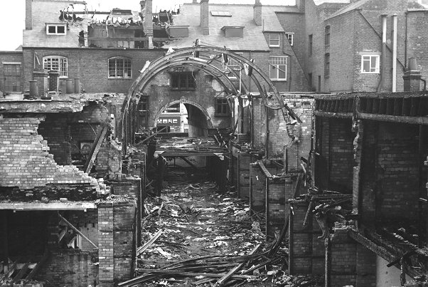
| Another view of the remains of the arcade, taken a day
or so after the fire. Whatever the cause may have been,
the fire rapidly took hold and by late morning the damage
had been done. It may have spread so quickly because of the
'chimney effect' caused by the long corridor. |
 |
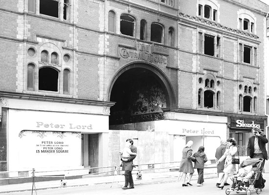 |
What remained of the front of the building after the
fire. The building had been completely gutted and was
declared unsafe. Shortly afterwards it was demolished. |
A sad looking, neglected Central Arcade, with many empty
shops. |
|
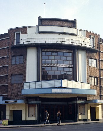
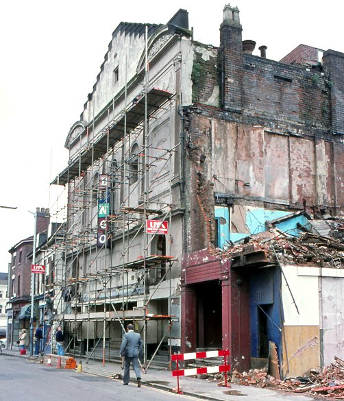
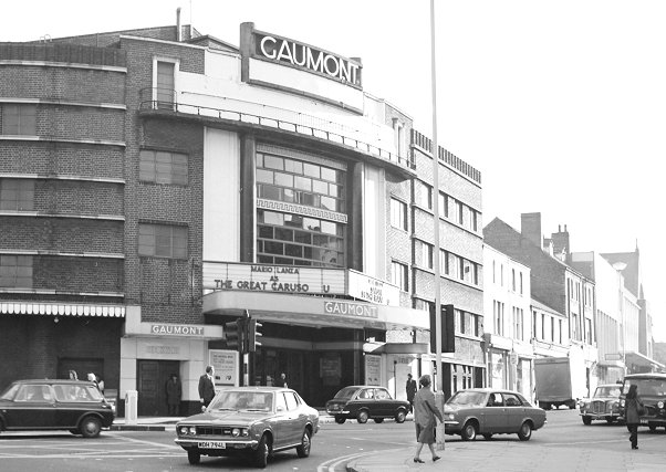
The Gaumont Cinema in 1974, just before demolition began. |
| The Gaumont officially opened on 5th September 1932 with
a showing of the Ben Travers farce, 'A Night Like
This'. It could accommodate 2,000 people, had a large café,
and a concealed organ that could rise from below the stage.
It closed on 10th November,
1973 and was demolished a few months later. |
 |
The junction of Powlett Street and Dudley Road. All of the buildings
in the photograph above were demolished when Ring Road St. George's
was built. |
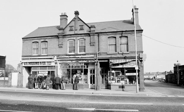 |
Another ring road casualty in Dudley Road was the well
known antiques and second-hand goods dealer J. E.
Higgins. He advertised as a modern exchange & mart. Many a
bargain could be found there. |
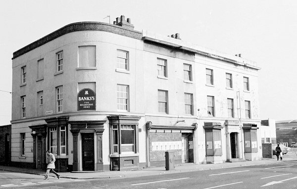
| The Melbourne Arms on the corner of Dudley Road and
Melbourne Street just before closure and demolition. It
was also a casualty of the building of the ring road. |
 |
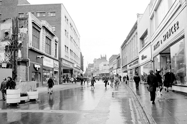 |
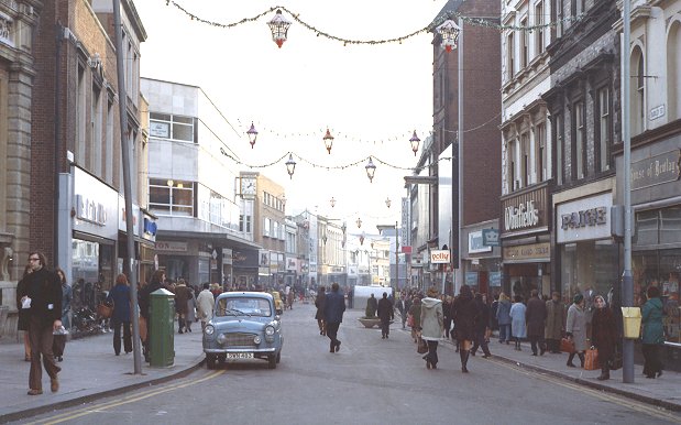
Dudley Street in the early 1970s, a few years before
pedestrianisation. Familiar names on the left include
Dewhurst the butchers, and Woolworths.
The right hand side is dominated by Marks and Spencer,
much as it is today.
|
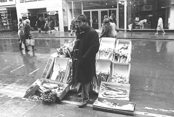
| A once familiar flower seller standing outside
Woolworths. Anyone who regularly shopped in Dudley Street
in the 1970s will have seen him. |
 |
|
A final view of Dudley Street, this time from the Queen
Square end. |
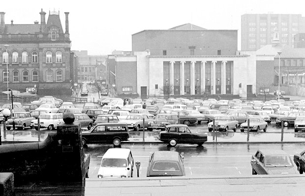 |
A view from 1973 showing the car park that stood on the
site of the present Civic Centre. A year later it was gone,
as work on the Civic Centre got underway. On the
right, work is progressing on the new telephone exchange. |
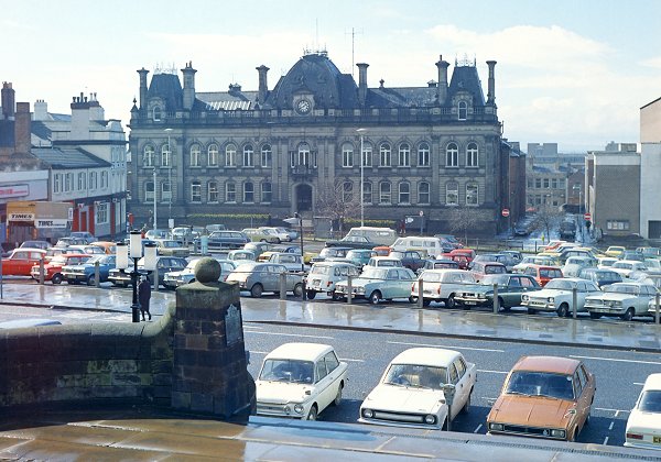
| Another view of the car park. On the left is the back
of Times Furnishing, and next door on the corner of North
Street and Cheapside is the Queens Hotel.
In the background is the Town Hall, which has hardly
changed. |
 |
|
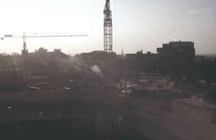
An evening's view of the construction of the Civic
Centre. Courtesy of David Parsons. |
 |
The wholesale market at the end of its life. The
elegant brick and terracotta building lay along the northern
side of the old market patch, opposite the Retail Market
Hall. It was designed by J. W. Bradley, and opened in 1903.
Demolition took place in the summer of 1973 in readiness
for the Civic Centre. |
| As the building was being emptied, I strolled around
with my Bronica S2A camera taking photographs. No one
stopped me, or asked who I was, or if I should be there.
Luckily I managed to get a number of black and white
photographs including the ones shown here. |
 |
 |
Many once-familiar names can be seen on the signs that
are still hanging from above.
It is hard to imagine the once-busy market, filled with
traders, and customers, and the large quantities of fruit,
vegetables, flowers, and fresh fish that were on sale.
It was a sad sight. |
|
The elegant building, partly demolished. |
|
Another view as demolition progresses. |
Behind the wholesale market stood the Municipal Cold Stores, with an
ice store, five cold store rooms, and an ice plant capable of making
ten tons of ice daily. On closure, the market moved to new premises
in Hickman Avenue. |
| A view looking across Ring Road St. Peter's to the
old St. Peter's School that stood on the site of
Wolverhampton University's library. On the left is the
University's 'C' Block that was demolished in 2000. |
 |
 |
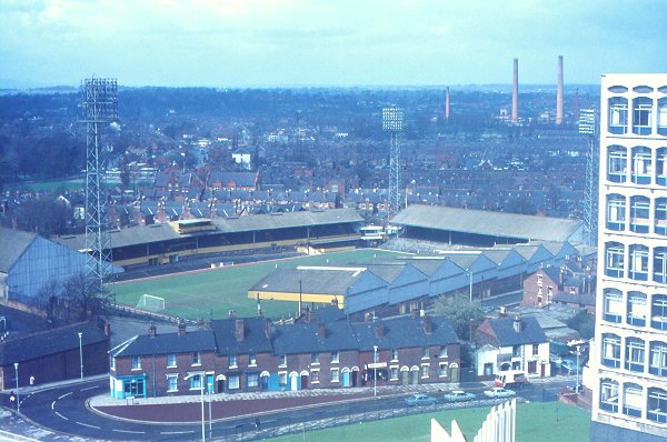
A view of the old Molineux football ground, and a
derelict Molineux Hotel taken from the top of St. Peter's
Church tower in the summer of 1988. On the left is the
Tarmac Building that was demolished in October 2010. |
| The Molineux Hotel in a derelict state in the 1980s.
The hotel closed in 1979 and lay empty for many years. In
June 2003 the building was almost destroyed at the hands of
an arsonist.
Wolverhampton City Council acquired the building, and it
was restored to its former glory with financial support from
Advantage West Midlands, the Heritage Lottery Fund, and
English Heritage. It is now home to the City Archives. |
 |
 |
A view of the football ground and the houses in North
Street from the University's 'C' Block in the early 1970s.
The chimneys in the background are part of Courtaulds' Dunstall
Hall Works, which produced Rayon.
The
factory closed, and was demolished in 1973 |
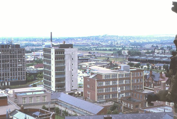
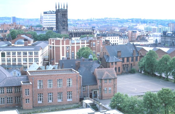
| A view of Wolverhampton Polytechnic (now the university)
from the top of St. Peter's Church tower in 1988. The grey
'L' shaped building in the bottom left-hand corner was
originally part of St. Peter's School.
On the right are some of the Carvers buildings that were
destroyed by fire in 2012. |
 |
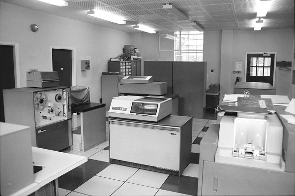 |
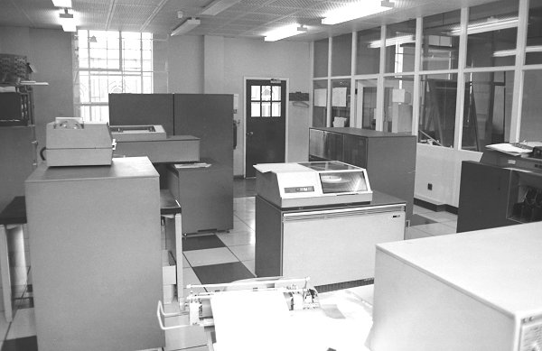
The old IBM computer at Wolverhampton Polytechnic in
about 1970. |
| Another view of the IBM machine. |
 |
 |
In the foreground is the old St. Peter's School, just
before closure. The buildings were acquired by the
Polytechnic.
Some were soon demolished, others remained in use for
many years. All have now gone. |
| Princes Square in the early 1970s. On the left is the
National Westminster Bank which closed in the mid 1990s and
is now the Indi Bar.
The Royal London Building on the right looks much as it
does today. |
 |
The large Co op store in Lichfield Street. It was designed
by Cleland and Hayward, and built by the CWS Building Department.
The new store, called Unity House, officially opened on Saturday
22nd August, 1931. Items on sale included clothing, footwear,
drapery, electrical goods, furniture, confectionary, and tobacco.
The store traded for over fifty years, closing on 11th July, 1987.
Part of it is now occupied by Wetherspoon's Moon Under Water pub. |
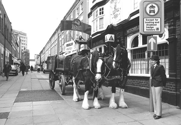 |
An unusual sight in the 1980s, a delivery of beer to the
Old Still in King Street, using magnificent horses and a
dray. The photograph was taken in the summer of 1984. |
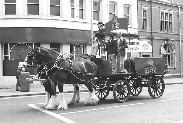
| Another photo of the horses and dray as they leave the
centre of Wolverhampton to proceed to their next delivery. |
 |
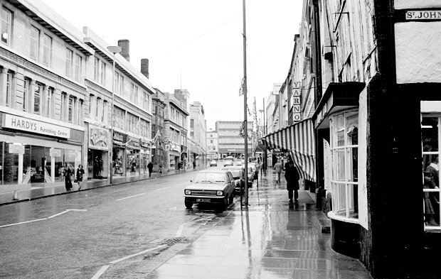 |
Victoria Street on a wet day in the early 1970s. On
the right is Lindy Lou's toy shop, and on the left is
Hardy's Furnishing Centre.
At the top of the street is the once-familiar Times
Furnishing store. |
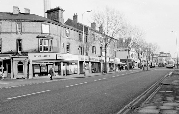
| A view of Chapel Ash with Meadow Street on the left.
On the corner is Jones and Griffiths estate agents. A little
further to the right on the corner of Lovatt Street is
the well-known Clarendon pub, Marston's show pub, which has
hardly changed externally since the photo was taken. |
 |
 |
A final view of Chapel Ash from the early 1970s taken at
the junction of Compton Road and Merridale Road. At the
time it was still a thriving shopping area with a wide
variety of shops.
On the right is Clifton Street. |
|
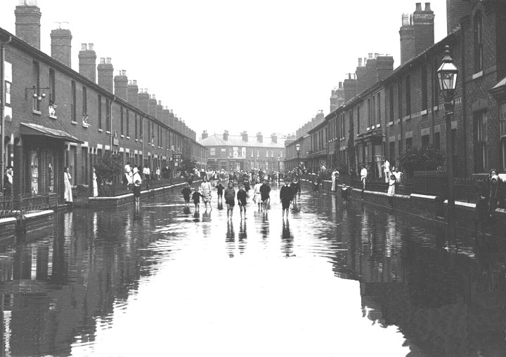
Flooding in Leicester Street, Whitmore Reans, in 1914. |
| A view of St. Leonard's Church, Bilston as seen from the
old Great Western Railway track bed, where the metro runs
today. The photograph was taken under the Arthur Street
bridge. |
 |
|
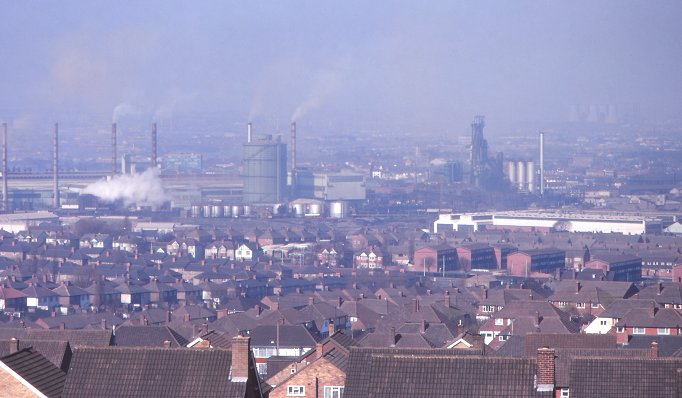
A view of Bilston Steelworks, as seen from Sedgley
Beacon in August 1970. In the far distance on the right
is Reedswood Power Station, in Green Lane Walsall. |
 |
|
|
|
|
Return to
Darlaston |
|
Return to the
beginning |
|
Proceed to
Wednesbury |
|
|