| Roads, Canals, and
Railways Wednesbury, like its
neighbours, exploited the plentiful supply of local
minerals and saw some early industrial development as a
result. Its industrial growth was very dependant upon
good roads, canals and later railways. In the early 18th
century the roads were still in an awful state, some of
the best being nothing more than well-worn cart tracks.
Most of the roads had deep ruts and so where unsuitable
for wheeled vehicles. One or two of the better ones such
as the Portway or possibly the Market Place were
causeways of cobble stones, called "stoneroads". In his
papers John Wesley described a quagmire on the outskirts
of the town, known as Hoo Marsh "where the road was in a
ruinous condition". Pack horses were used instead of
wheeled vehicles, and fitted with panniers called "dassells"
on which to carry heavy items such as coal or iron.
The situation began to improve in
1726 with the Passing of the Turnpike Act which resulted
in many improvements to the local road network,
including the road from the High Bullen to Birmingham.
The roads are described in the Act as follows:
| “so ruinous and
bad that in the winter season many parts are
impassable for wagons and carriages, and
very dangerous for travellers.” |
The Act allowed authorised Trustees
(usually made up of local businessmen) to collect
tolls for 21 years in return for repairing a
particular road.
Accordingly turnpikes (a gate or barrier) were set
up to collect the tolls.
Parliament created the first turnpike trust in 1706
and their numbers rapidly grew, so much so that by
1830 there were around 1,100 of them, created by some
4,000 separate acts.
The tolls were paid by users once a day for the whole
length of the road, and regular users could pay
quarterly.
|
|
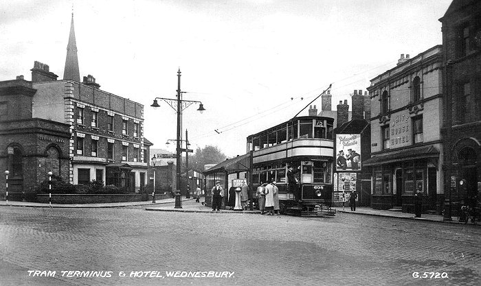
The old tram terminus next to the
White Horse in Bridge Street. |

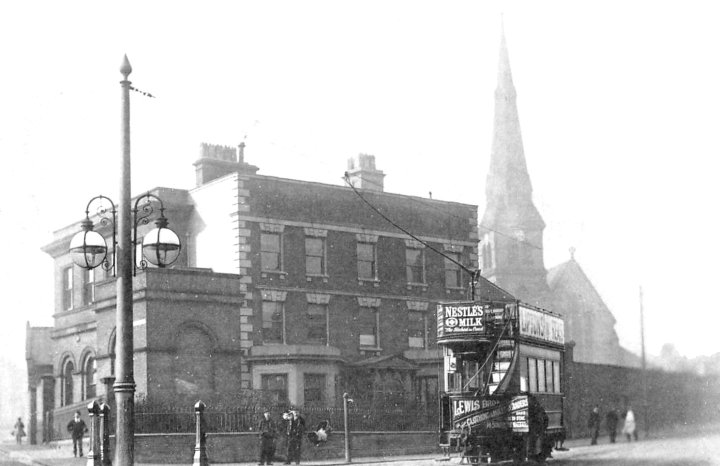
Another view of the old tram terminus next to the
White Horse in Bridge Street.
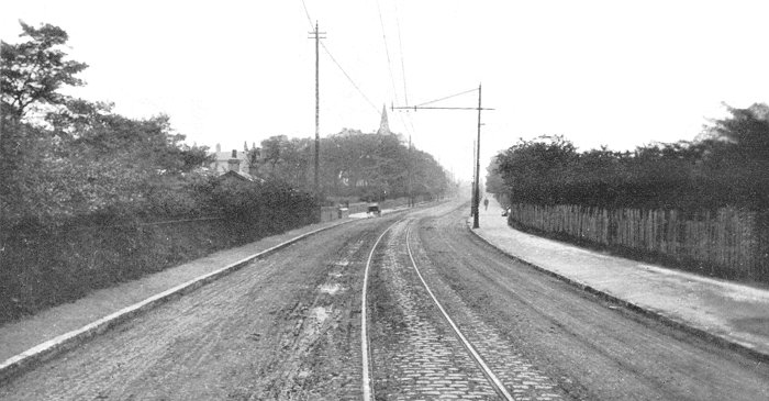
A tram turning into Lower High Street.
|
Two turnpikes were
set up in the town for the road to Birmingham. One was
in Lower High Street and the other in Upper High Street
near the High Bullen. Because large numbers of carriages
and carts used the road, the repairs had not been
completed within the allotted time span, and so the Act
was extended to 1748 and again to 1771. Thanks to the
turnpike acts the local roads were greatly improved and
later augmented by the coming of the canal. In 1787 the
Act was Passed for the making of a new road from
Wednesbury
to Darlaston
starting at Trouse
Lane and going across Kings Hill to produce
Darlaston Road. The original routes to
Darlaston were either via Bilston Road, Dangerfield Land
and Woods Bank, or via Park Lane and Walsall Road. The
new road was a more direct route and a great
improvement.
The last major road
development before modern times was the building of
Telford’s Holyhead Road. Thomas Telford the
talented Scottish engineer, surveyed the route and
presented his plans to Parliament in April 1811, though
it took another four years before the funds were
authorised. The new road took 11 years to build at a
cost of more than £500,000.
The section through Wednesbury was completed in about
1826 and placed under the Bilston Turnpike Trust who
built a toll house at the top of Dangerfield Lane. It
provided a much improved route to Birmingham and
Wolverhampton, as well as further
afield.
Wood Green in 1908.
Wood Green.
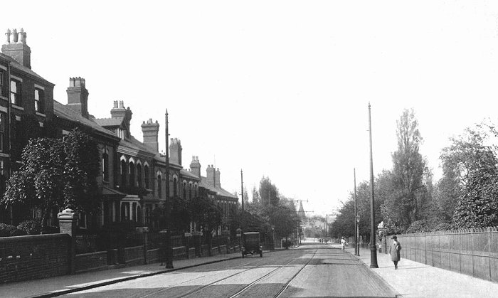
Another view of Wood Green. From
an old postcard.
Canals
The local canal network, the Birmingham Canal
Navigations (BCN) was built to transport coal from the
Black Country coalfields in the Wednesbury area into
Birmingham. James Brindley surveyed a possible route in
1767 and during the following year an Act of Parliament
was Passed to allow the construction to go ahead.
James Brindley
was appointed as engineer to the newly formed Birmingham
Canal Company, and work soon got underway. The section
from Birmingham to Wednesbury opened on 6th November,
1769. The canal reached Wolverhampton in August 1771,
and the final section to Aldersley Junction opened on
21st September, 1772, just 8 days before Brindley's
death. The circuitous route followed the natural
contours to avoid as much large-scale engineering work
as possible, and the total distance of 12½ miles as the
crow flies from Birmingham to Wolverhampton, was covered
in just over 22½ miles.
The canal was a
great success. Large quantities of coal, limestone,
sand, and Rowley ragstone were transported far more
cheaply and quickly than ever before, benefiting both
the canal company and the mining companies alike. The canal
company went from strength to strength as the canal
expanded and other canal companies were taken over.
|
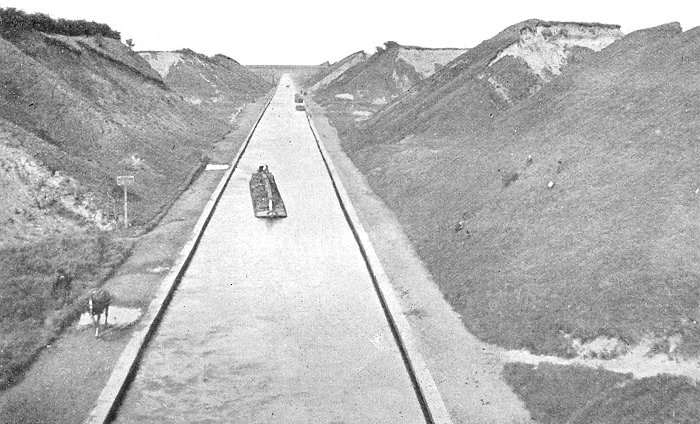 The Tame Valley Canal from the
Crankhall Lane Bridge.
The Tame Valley Canal from the
Crankhall Lane Bridge.
| In 1783 an Act of Parliament was passed that allowed
the existing canal at Wednesbury Holloway to be extended
from Ryders Green to near an old mine pumping engine at
Broadwater.
Under the terms of the Act, all the mine owners who
had pumping engines had to raise the water from their
mines to the level of the canal at Willingsworth, and
arrange for it to be fed into the canal, to maintain its
water level.
One of the water feeds came from the pumping engine
at Hobbs Hole Colliery which belonged to the heirs of
Richard Parkes.
The water course became known as 'Quaker's Gutter',
possibly because one of Parkes' heirs, his grandson,
Sampson Lloyd the third, had a grandson, Samuel Lloyd,
who became known as 'Quaker Lloyd'.
|
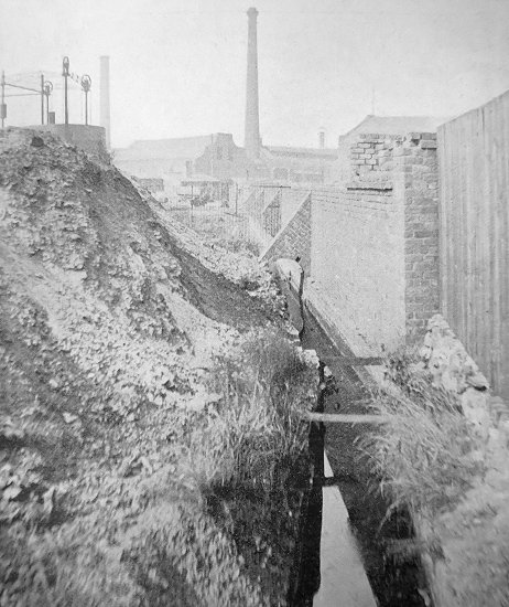
Quaker's Gutter. |
|
An Act in 1874
allowed the Broadwaters branch to be extended through
Darlaston to Walsall, and the whole stretch from Ryders
Green to Walsall became known as the Walsall Branch.
By the 1820s the
BCN carried a lot of traffic which was greatly hampered
by the circuitous route. Something had to be done to
speed the flow of traffic and so in April 1824 the
engineer Thomas Telford was engaged to survey the canal
with the idea of shortening and improving the route.
Many of the bends were cut off and a new straight line
was built between Smethwick and Bloomfield, which
shortened the canal by 7 miles. Later engineering work
included the building of the Netherton Tunnel in the
1850s.
In 1839 work began on an alternative
route into Wednesbury with the building of the Tame
Valley Canal from Doe Bank junction at Ocker Hill to
Salford Junction on the Birmingham and Fazeley Canal.
The canal opened for business on 14th February, 1844
The BCN was
leased by the London & Birmingham Railway in 1845, and
from 1846 by its successor the London & North Western
Railway.
Railways
The first railway to be built in the area was the
Grand Junction Railway, which linked Liverpool and
Manchester with Birmingham. It skirted the north eastern
edge of the town, with a station at Bescot Bridge, which
opened at the same time as the railway on
4th July, 1837. The locomotive "Wildfire" pulled the
first train, consisting of passenger and mail coaches. A
year later links with London were improved with the
opening of the London & Birmingham Railway, which would
soon join forces with the Grand Junction Railway in the
formation of the London & North Western Railway in 1846. |
|
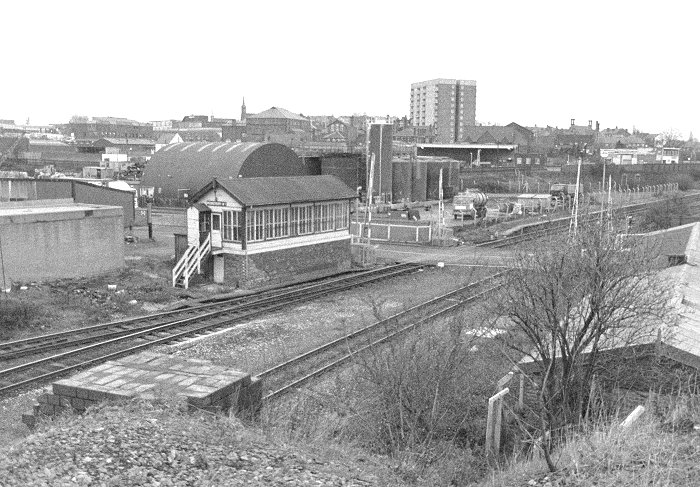
Wednesbury's last signal box, the
old LNWR box in Potter's lane. |
|
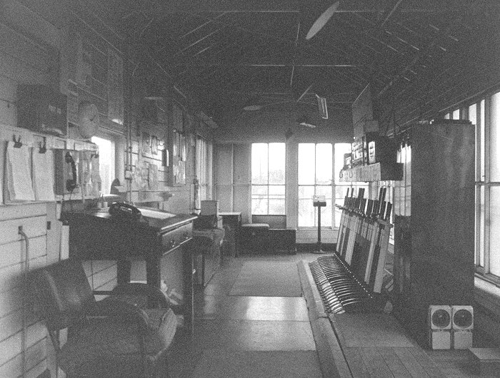
The interior of the London & North
Western Railway signal box. |
|
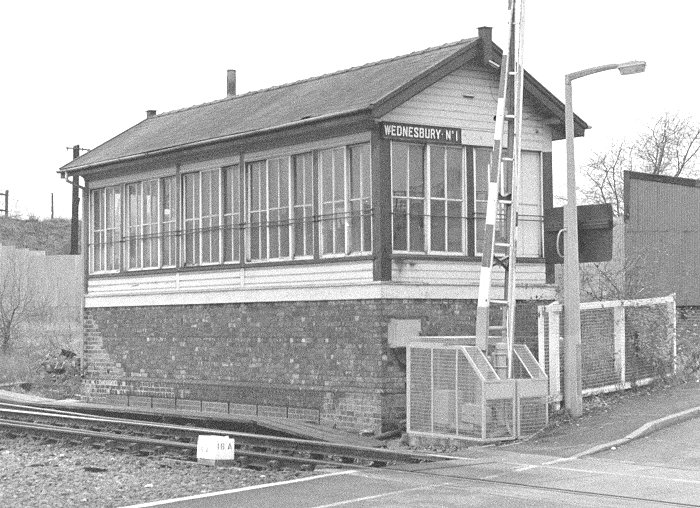
The signal box, as seen from
Potter's Lane. |
|
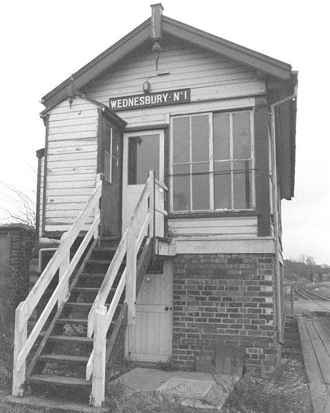
The signal box entrance. Sadly
the signal box was destroyed by a mindless arson
attack in 1995. |
The South Staffordshire Railway built a line from
Walsall to Bescot Junction in 1850. In the same year
Bescot Bridge Station closed to be replaced by the
existing station at Bescot Junction.
The South Staffordshire Railway was extended in 1863
with the building of the Darlaston Branch, which ran
from James Bridge, through Darlaston and Wednesbury to
Princess End. It resulted in the building of
Wednesbury's first town centre station.
The line officially closed in
1964 but the Walsall to Round Oak section continued
in used until March 1993.
In 1881 Wood Green station opened on the site of the
former Bescot Bridge Station and 6 years later passenger
services to Darlaston were withdrawn due to
competition from the local tram company. |
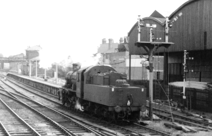
|
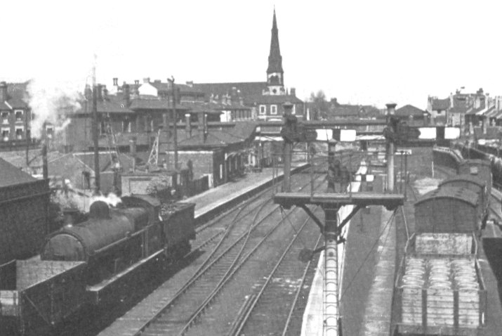
The railway station in
1954. |
A final view of the
railway station in British Rail days with the
buildings that were part of Walsh Graham's timer
yard in Potters Lane, on the right. |
| Wednesbury's other town centre station opened in Great
Western Street on 14th November, 1854 when the
Birmingham, Wolverhampton & Dudley Railway began its
operation. The railway was part of the Great Western
Railway and initially had mixed gauge track, until the
broad gauge was abandoned in 1869.
The future of the line was in doubt from the time of the
electrification of the West Coast Main Line. While the
electrification work was in progress the ex-GWR line did
see a large increase in traffic, but once the West Coast
Main Line had reopened, services were quickly reduced.
The last Paddington to Birkenhead express ran in March
1967, the line closed in the early 1970s and
Wednesbury's old Great Western station was soon
demolished.
The line is now used by the Midland Metro, and
carries more passengers than ever. |
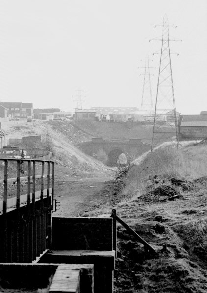
Hill Top tunnel, before the
Midland Metro. |
|
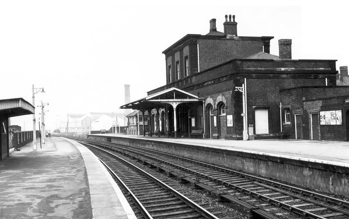
The Great Western Railway Station.
|
|
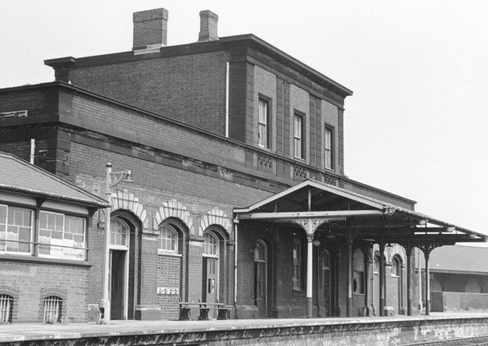
Another view of the Great Western Railway Station. |
|
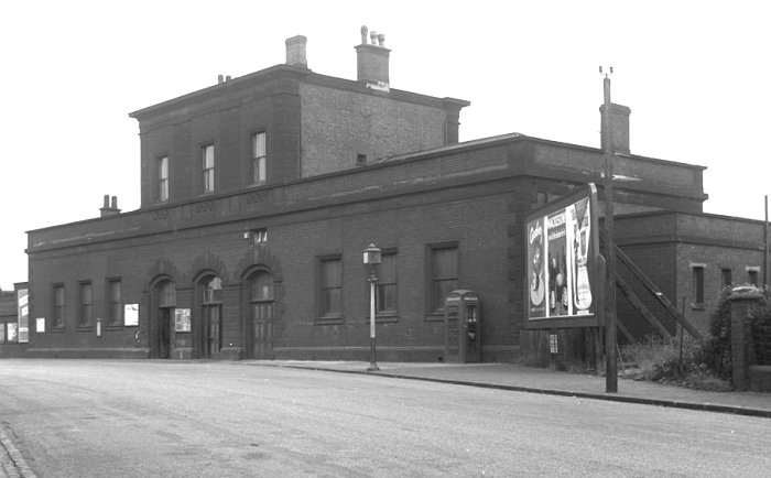
The Great Western Railway Station,
seen from Great Western Street. |
 |
|
|
|
|
Return to
Early Industry |
|
Return to
the contents |
|
Proceed to The
Growing Town |
|